Yo!

Greetings, my friends.

Just some simple sharing of places that I’ve been to, not the kind of city-travel blogs, but memories of roads less travelled.

Rule of thumb (my theory), don’t be tempted by photos of easy trails. There won’t be enough energy (or hands) to take pictures on exhausting or dangerous parts of the trail. 🙂


Disclaimer: I do not claim credit for all the photos in the subsequent posts. Some were taken by my friends and shared. I can’t remember who took which photo, so please pardon me for not acknowledging. Dear friends, sorry for not seeking permission to use your photos before posting. Do let me know if you wish to have your photos removed.

Southern Ridges Trail

Went to AST for a course this afternoon and planned to take the Southern Ridges Trail back to Harbourfront MRT as AST is near to Hortpark.

Packed a change of clothes, wore comfy shoes for the day. Not the first time walking from Alexandra Arch to Harbourfront but got lost the previous time and so was more cautious this time round.

Planned for a leisurely walk through the park and gave myself 1.5hr. But a friend was able to meet up at Vivocity at the very last second, so in order not to keep my friend waiting, I took the shortest route (including climbing up stairs) and managed to finish in a record time of 45 min!

For those who are unfamiliar, the southern ridges trail starts at Harbourfront mrt, and ends at the Canopy walk at Hortpark. The whole trail takes about 2-3 hrs to complete.

I started my journey at Alexandra Arch where the walkway is built on a raised platform.

20140403-013500.jpg

20140403-013733.jpg
(Pics: raised metal walkway)

Continued walking along the road pavements and passed Sembcorp forest of giant (trees); Henderson Waves bridge, Jewel Box and lastly Marang Trail before the Harbourfront MRT end point!!!

20140403-014459.jpg
(Pic: Henderson Wave bridge. It’s rare capturing a photo of the bridge without people in it!)

20140403-014520.jpg
(Pic: steps along Marang Trail)

Journey ended – happy for finishing the trail in a personal best record time! Hope to return for another round of urban trekking soon! 🙂

Gunung Datuk

I came to know about this mountain (or hill) when one of my friends jio-ed (jio = singish for friendly invite) me to climb it over one of the weekends (in late Sept 13) as a post Mt K trip. But due to our tight schedules, we did not manage to go. But I read up about the hill and got slightly interested.

So when another group of friends jio-ed me to go on this trip over a long weekend in early Nov 13, I thought, why not? But that was after months of inactivity due to injured toenails from Mt K, so I had to squeeze in some training within two weeks before the climb, which was seriously not enough.

It was a 2D1N trip with Adventure Quest (AQ), the same company whom I went with to Poon Hill, Nepal in Dec 12 (more about that in another post).

We took a mini-van from Sg in the evening, and drove up towards Rembau. We tried to sleep along the journey but only managed to catch a bit of sleep as we were all very excited. We reached the foot of the hill at about 3.30 am, took a short break to freshen up and change into our trekking gear, and warmed up. We started climbing at about 4 am  in the morning, aiming to reach the summit before sunrise.

It was a challenge to navigate in the dark as we were deprived of the overview of the terrain and could not make informed choices regarding the route we should take as we went uphill. The ascent was steep, with majority of the path among tree roots and rocks. There were no rest stops or toilets or water points along the way too. Only a small clearing beside a collapsed hut that served as a rest point for us.

IMG_0949


(Pic: one of the collapsed huts next to a clearing about 1/3 of the way up. The only ‘official’ checkpoint we had.)

IMG_0937

(Pic: The huge boulder as our unofficial checkpoint about 2/3 of the way up. Very grateful for this huge boulder for an excuse to take a break.)

IMG_0947

(Pic: The kind of route we had to pick our way through majority of the time.)

It was tedious climbing for an unfit climber like me. There were countless moments when I just felt like giving up and turning back. But luckily for my trek mates. Most of whom I’ve just met for the first time that day. Its due to their encouragement and ‘pushing’ that I continued to climb on. (Actually felt very stressful to have people behind me talking away while I’m the ‘limiting factor’ road-hogging the path)

IMG_0954 IMG_0959 IMG_0960

(Pics: the super-huge boulders at the summit)

Finally reached the clearing before the summit (after sunrise though). Exhausted but happy. However, in front of us were long ladders leading to the summit. They look unstable and despite what others claimed on their blogs, they are really UN-stable!!! The ladders are just secured at the top with several ropes and were super shaky. The ascent took some skill and luckily lots of guidance from my friends. (I reluctantly went up because all my other friends were up there). The descent took even more skill and guts…. (as usual).

People are always happy because they have reached the summit, but little did they realise that its just half the journey completed. The descend is much strenuous than the ascend.

IMG_0968(Pic: Scenery at the summit)

Despite all the hardships climbing up and down the mountain, the scenery at the summit and the accomplishment felt when you’ve reached the end point, makes it all worth it. I didn’t train much, the terrain was tough, I wanted to give up numerous times, but still completed the trek –> never give up!

Mt Kinabalu

First time to Kota Kinabalu, Sabah was in June 04 (i think), but didn’t make plans to climb Mt K. Just went to one of the starting points of the climb (Timpohon gate) to sightsee. It was very misty and cold, and I felt that it was a pity not to climb Mt K since I’m in Sabah.

Second time to KK was in Nov 09, helping to bring a group of students there. It was a last minute decision as there was a sudden vacancy and since I’ve always wanted to try climbing Mt K, I agreed and went without much training.

For those familiar with the usual schedule: Day 1: from Start point ascend until Laban Rata and stay for the night, Day 2:  from Laban Rata to summit, then back to Laban Rata and then descend. (Of course, it is also possible to complete everything within one day or extend for one more day at Laban Rata before descending)

It was raining heavily, so we were soaked and tired and decided not to summit the next day but instead get more rest, and descend earlier, thus, regret no.2 – didn’t manage to summit after coming so far.

But this climb showed me how unprepared I was: (1) I didn’t have sufficient water-proofing: my one and only poncho tore and so I was soaked, (2) I didn’t have a rain-cover for my backpack, so it was also soaked too and thus heavier. (3) I didn’t bring enough drinking water, and had to refill from the water tanks along the way (which could have caused the serious stomach upset throughout the night at Laban Rata). (4) Didn’t have enough warm clothing (as it gets cold from Laban Rata upwards), so was freezing throughout the night (the soaked clothes didn’t help).

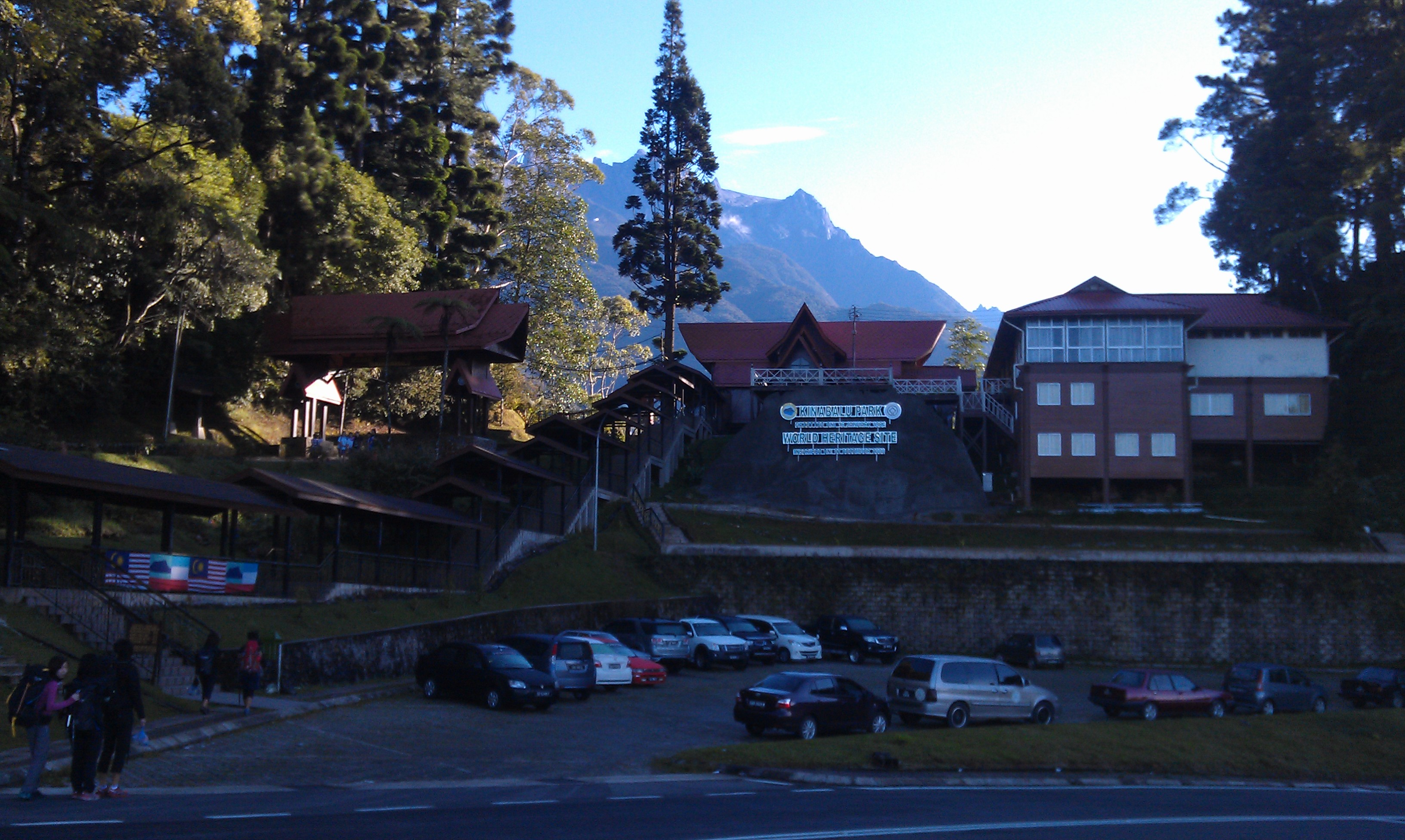
Third time to Kota Kinabalu was Sept 13. Going to attempt to summit Mt Kinabalu again with a few of my friends. We started from Timpohon gate – the more popular starting point because of the shorter distance but also a steeper and tougher track.

Image

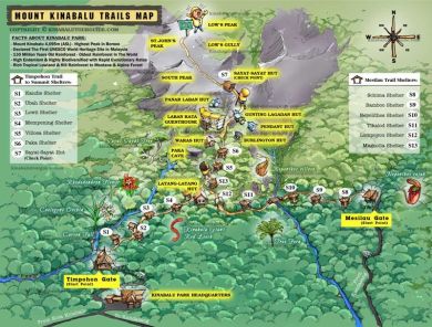
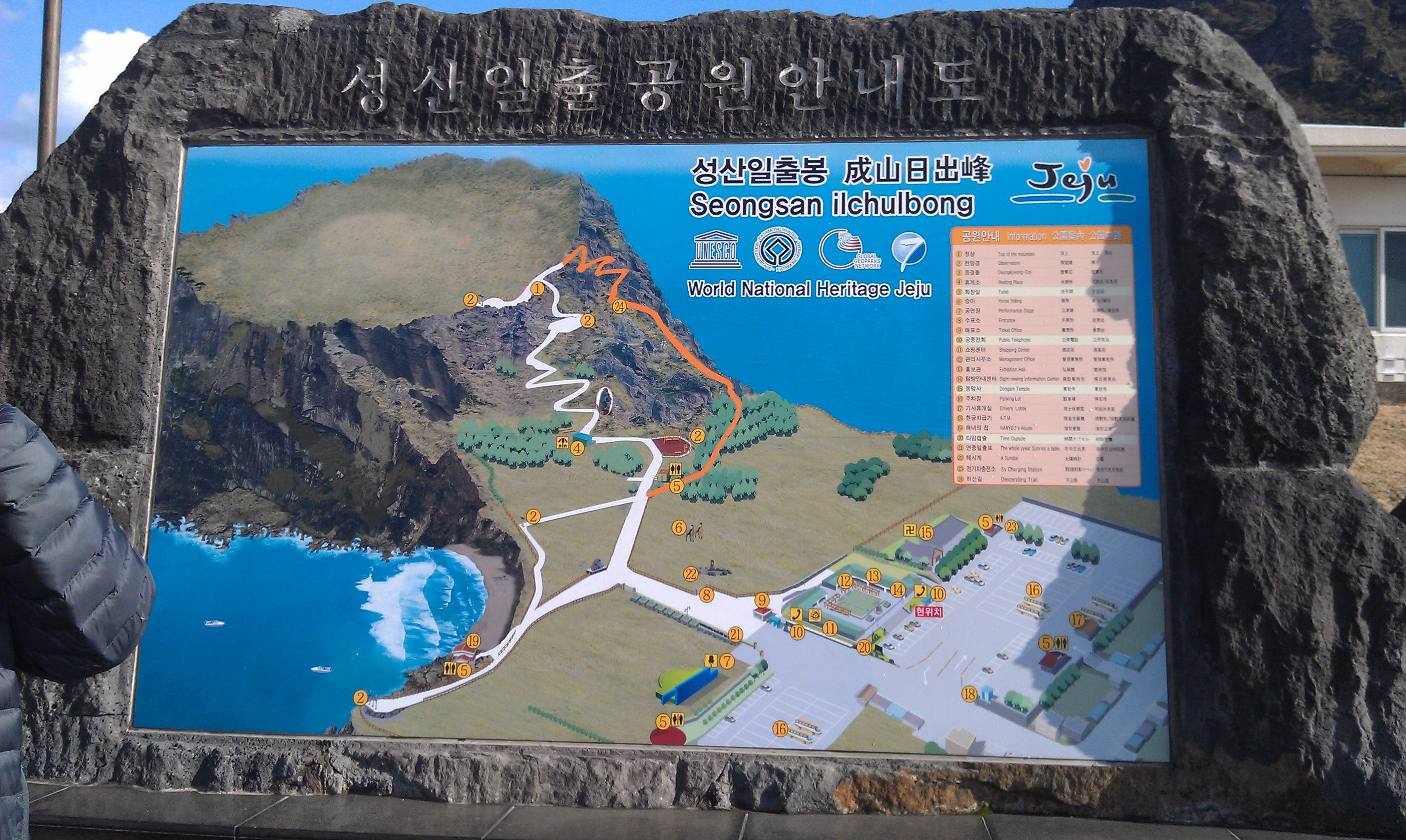
(Pic: Map of Mt Kinabalu)

IMAG0356

(Pic: Walk to registration point just after dawn)

64552_10151666431923302_1164008494_n

(Pic: Fresh and energetic before start)

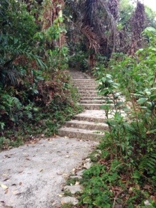
After registration and meeting up with our guide, we ate breakfast (fried rice with egg) at the starting point and collected our packed lunch before starting the journey. We started off well, charged by the carbo load and quickly completed the first 1 km of the uphill climb.

IMAG0358

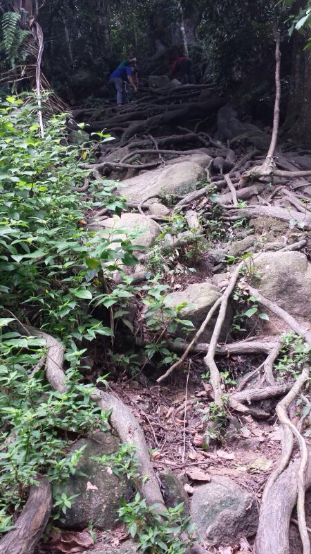
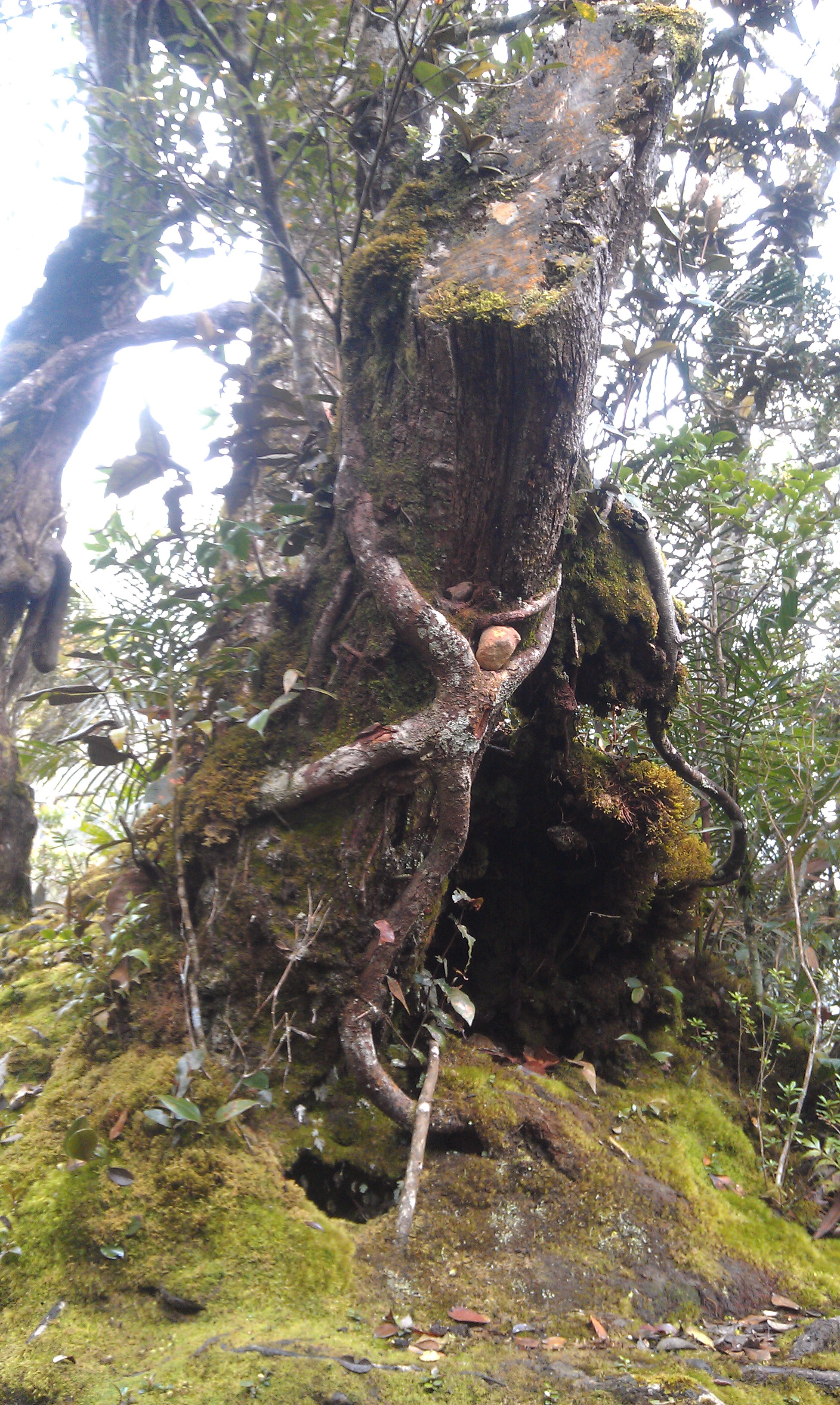
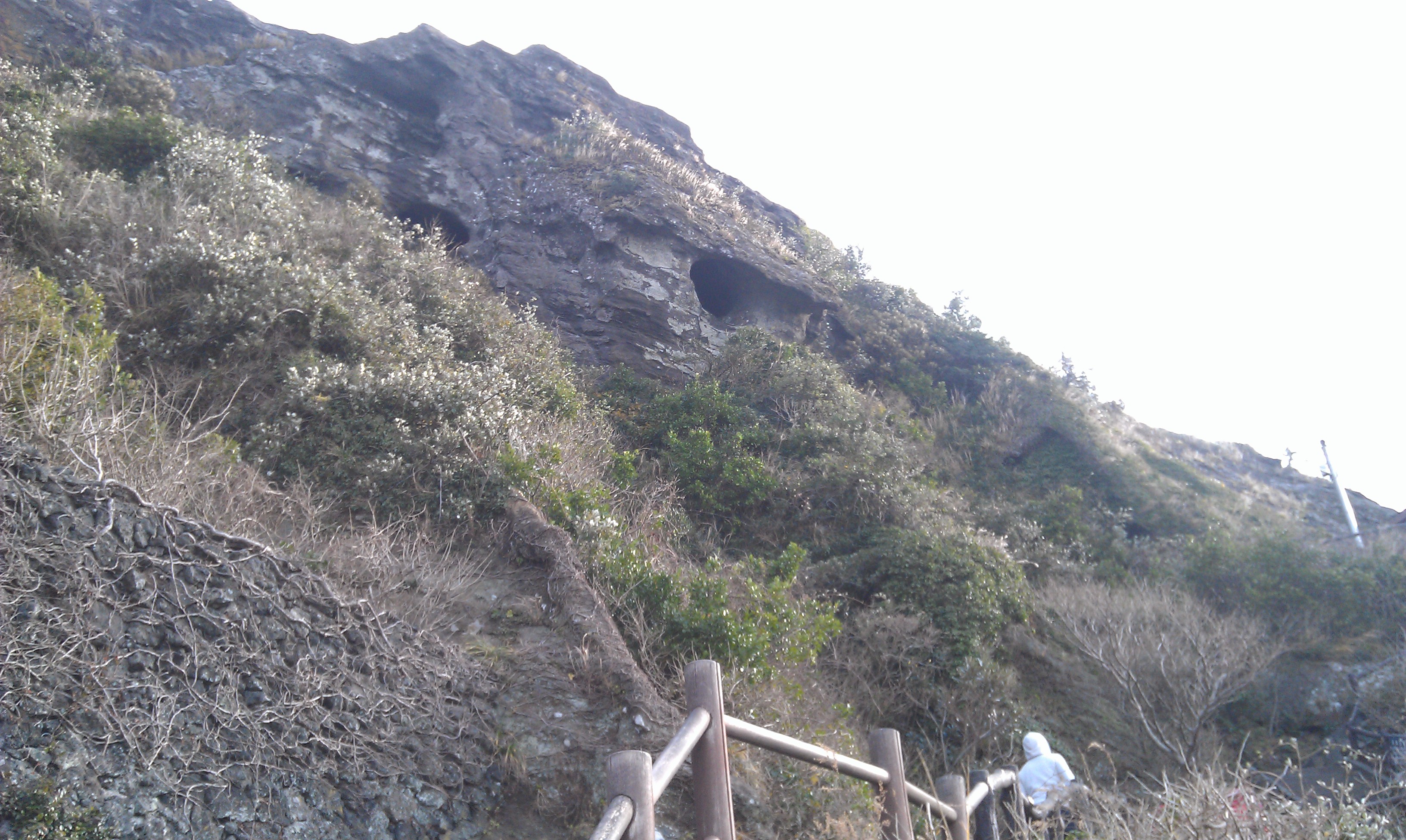
(Pic: One of the many trees)

This cute tree was spotted beside one of the first few huts of the trail. After the initial 1 km, there was no chance (and no energy) to take any pictures as it started pouring (again). We battled through the rain for the next 5 km to Laban Rata. We were still soaked through despite taking precautions (e.g. poncho, raincover for bag etc).

1380314_10151666432088302_1155408775_n

(Pic: Tired faces)

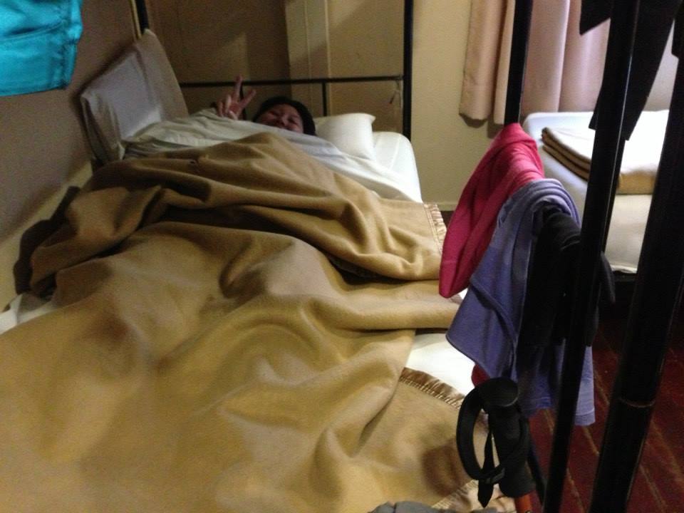
We reached our shelter for the night after about 6 hours of tedious uphill climbing, changed into dry clothes and had an early dinner. All of us were very tired but couldn’t really sleep well probably due to nerves or that we tried to force ourselves to sleep too early as we know that we had to wake up at 2 am for the summit climb. 

561393_10151654314863302_86153641_n

(Pic: Tired but can’t sleep)

At 2 am the next morning, we woke up and got ready for the summit climb in the dark. We made our way slowly and carefully up the dark and damp wooden stairs and uphill slopes, following a white marker rope. The first part of the summit climb was still manageable, with steps along the way until Sayang Sayang hut….. After the hut, the climb was steep on slippery granite rocks. We had to haul ourselves up a nearly vertical slippery slope, and balance on the along the edge of the cliff wall, all in the dark. The darkness was a blessing (by the way), since we could not see the potential danger of the route we were taking. One false step could send us to the hospital (if we are lucky)…

Of course, there are no photos of that part since its dark, and both of my hands are used to hang on to the rope (for my dear life). I’ve lost contact with my friends at that point since they were all faster and went on ahead. I was glad that it did not rain, because if it rained, the summit would be out-of-bounds, and it would be a waste of effort climbing all the way but didn’t manage to attempt summit.

IMAG0359

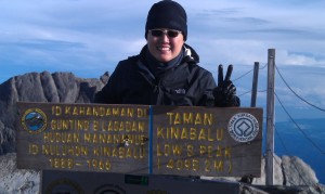
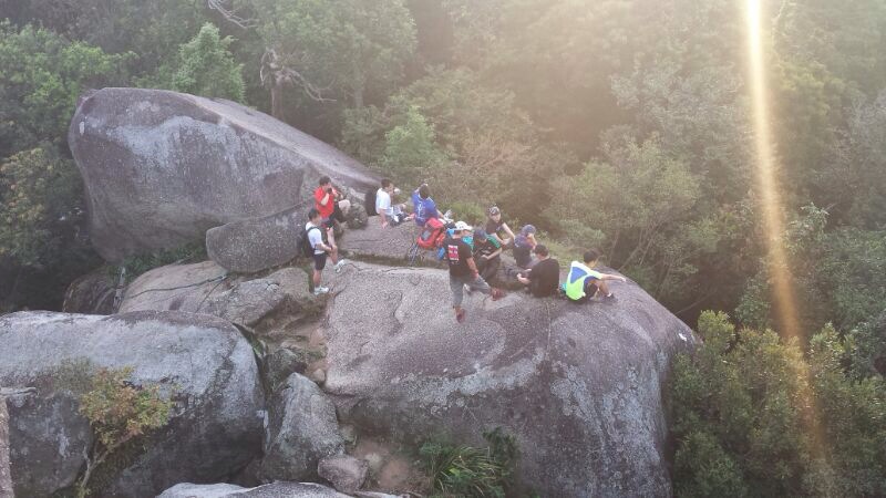
(Pic: At the summit!)

I took too many breaks and didn’t push myself to go fast enough for the summit climb, so only managed to reach the peak after the sun has risen. Nonetheless, happy to have reached there after an exhausting uphill climb, only to realise that its only half the journey 😦

However exhausting the uphill climb was, the descend was 10 times worse.  I had to balance on top of unstable boulders on the way down, and abseil down steep granite walls. Since the sun has risen by now, I could see the actual path we took when ascending. And I couldn’t imagine how I managed to get past those treacherous paths while ascending in the dark.

IMAG0361

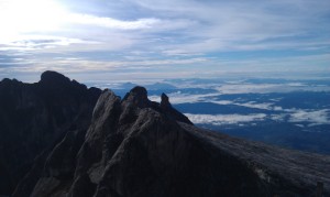
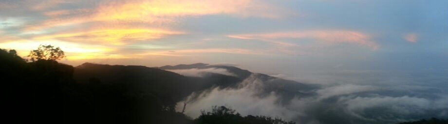
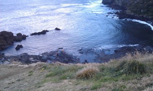
(Pic: View of other peaks)

It started raining (again) on the way to Laban Rata. And the wooden staircase got so slippery at certain points that I (and another person behind me) slipped and fell. Upon reaching Laban Rata, I felt that my legs were going to buckle under me at any time. Was really tempted to stay one more night at the lodge and descend the next day. No such luxury though. Had to drag my tired body and try to command my legs to descend each step in order not to tumble all the way down.

As usual, murphy’s law at work even on the mountains, the rain started getting heavier until we were wading through ‘rivers’ and mini waterfalls cascading down the steps…. No energy to move, knees and muscles protesting, toes bruised, cold and wet from the rain, but no choice, I couldn’t just give up in the middle of nowhere. After 6 hours of descending, I’ve finally managed to reach the end point! (my friends reached first and they waited for me, shivering in the cold… sorry, my dear friends.)  

I took 6 hours of ascending, 6 hours of summit climb, and 6 hours of descending in 2 days. 4095 m asl. The highest place I’ve set foot on, as of now. Like what one of my friends said: once is enough (for now).

Without this quote, I don’t think I could have made it to the top and back: “It is not the mountain we conquer but ourselves” ~ Sir Edmund Hillary.

Seongsan ilchulbong

Went to Korea in Dec 13 and went to this crater-peak Seongsan ilchulbong in Jeju island. Its a tourist hotspot due to its UNESCO World Natural Heritage status and the best place to view sunrise. But since we reached there at about noon, we didn’t manage to catch any sunrise. 😐

IMAG0735 Image

(Pics 1&2: View of crater and UNESCO heritage site)

Image IMAG0752

(Pics 3&4: Map of the area and view of peak from mid-way)

From the entrance, the path splits into two. The right leads to the crater-peak, and the left path leads to the bay.

IMAG0766

(Pic 5: view of bay)

We took the stairs up to the crater-peak. It was windy, but the view was superb!

IMAG0740 IMAG0759

(Pics 6&7: Breath-taking scenery and well-paved downhill steps)

It takes only about 20-25 min to reach the peak (inclusive of catch-our-breaths breaks disguised as admire scenery/photo-taking breaks). 

IMAG0754 Image

(Pic 8&9: View of crater and plaque to mark the peak – 180 m)

Bukit Timah

Bukit timah hill is this small mount of earth located to the west of the central catchment area in Singapore. Its one of the higher (if not highest) natural places in Singapore. People go there for many reasons – some bring their family there for picnic (many did not take the steep slope at the foot of the hill into consideration before bringing their elderly family members along), some do research there (I did a project for one of my uni modules there), some go there to jog or cycle to keep fit (I envy those who stay nearby and those who drive), some go there to keep in touch with nature, and others, like me, torture ourselves at Bukit Timah in the hope that our bodies may be better conditioned for an upcoming trip (other than climbing the stairs of HDB’s point blocks).

Bukit timah map

(Picture 1: map of Bukit Timah hill)


Most visitors set off from the visitor centre at the foot of the hill. Then, they can either take the paved path up the hill, or take other sandy / muddy / rocky paths which leads to and from the summit. My personal favourite route is to take the steep slope up, then take the stairs up to the summit, and then descend via the yellow path, and then detour to dairy farm loop. This is by far the best route to train (in my opinion), but it is also the fastest way to wear out your knees due to the long flights of stairs.

The scariest path (to me) and also the most special path is the rock path. It starts off as an ordinary sandy path, but in the centre of the path, there’s a very steep rock face which requires one to use all four limbs to climb past. Its the one path that I would not choose to go to if I had the choice.

Bukit timah Aug 2013

(Picture 2: proof-of-attendance photo at the summit)

If you look around you, you may find some interesting flora and fauna too. I’ve seen monitor lizards, rare birds, and also the ubiquitous monkeys in addition to all the trees and ferns and palms.

Bukit timah tree

(Picture 3: tree with a mouth along path to summit)